


Storm System Moves Away from Massachusetts, Clearing Expected
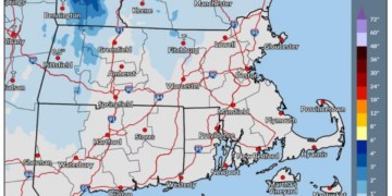
A slow-moving storm system that brought unsettled weather across Massachusetts this weekend is finally beginning to move off, as confirmed by the National Weather Service.
Residents can look forward to improved conditions and brisk winds on Sunday as cooler, drier air flows into the area.
Weather Update and Forecast
The low-pressure system responsible for cloudy skies and scattered showers is advancing toward Nova Scotia, with the final remnants of precipitation expected to dissipate by Sunday morning.
Throughout the afternoon, skies will gradually clear from the southwest to northeast. However, areas in Central and Western Massachusetts with higher terrain may experience cloud cover for a longer period.
As the clouds part, expect breezy west to northwest winds, with gusts potentially reaching up to 30 mph. It may feel significantly cooler outside than the temperature reading suggests.
Sunday’s temperatures are anticipated to remain slightly above normal for this early November period. Boston and Springfield are projected to reach the upper 50s, while Worcester and Pittsfield may see highs in the low to mid 50s.
Overnight Conditions
As night falls, skies are likely to remain mostly clear, and winds will calm down. However, cloud cover will begin to reemerge by early Monday, particularly in the western regions of the state. Overnight lows will range from the upper 30s inland to the upper 40s near coastal areas.
Temperature Forecast for Major Cities
- Boston: High 58°, Low 47°, Cloudy with a chance of overnight showers
- Hyannis: High 59°, Low 46°, Mostly cloudy transitioning to sunny
- Pittsfield: High 52°, Low 39°, Chance of showers with cloudy conditions
- Springfield: High 58°, Low 37°, Mostly cloudy with gradual clearing
- Worcester: High 57°, Low 39°, Mostly sunny
Looking Ahead to Monday and Beyond
Monday is expected to be mostly dry, although some showers may linger in Western Massachusetts. Clouds are predicted to remain, particularly in the higher elevations of Central and Western Massachusetts. Despite this, temperatures are set to stay slightly above seasonal averages as the week begins.
Tuesday will bring a breezy atmosphere as another low-pressure system moves northeastward, although Massachusetts is forecasted to remain mainly dry. Highs will drop back into the 40s and 50s, more typical for mid-November, with lows expected to fall into the 30s, especially inland. This pattern of variable clouds and sunshine will continue through Wednesday.
Potential Storm System on the Horizon
As the week progresses, meteorologists are monitoring a possible storm system that may develop off the mid-Atlantic coast. If it occurs, it could usher in another round of unsettled weather for Massachusetts by Thursday or Friday.
With temperatures forecasted to decline towards the week’s end, areas in the interior and higher elevations could see rain transitioning to wet snow, while coastal regions are more likely to receive rain. However, considerable uncertainty remains regarding the storm’s trajectory, timing, and intensity. Residents are encouraged to stay updated with the latest forecasts as the week unfolds.

Chief Editor of Quincy City Beat — Quincy, MA's independent investigative newspaper covering Greater Boston and the entire Commonwealth of Massachusetts with fearless public accountability and free access for all readers.








Discussion about this post