


Massachusetts Weather Update: Storm System Winds Down
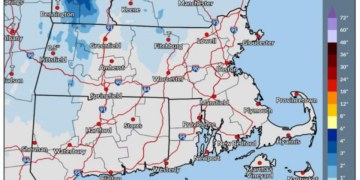
A storm system that delivered rain and snow across Massachusetts is gradually easing as of Friday morning. The precipitation is anticipated to diminish for most regions by late morning into the early afternoon. However, strong gusts of wind will persist throughout the day, particularly affecting Cape Cod and the Islands.
Current Conditions and Long-Lasting Effects
Most areas have already experienced the heaviest impacts of the storm. While rain, occasionally mixed with snow flurries at higher altitudes, continues to fall on Friday morning, it is expected to dissolve for interior and northern Massachusetts by late morning. Southeastern Massachusetts and Cape Cod, however, may experience showers through the afternoon and evening along the south coast.
Wind and Coastal Concerns
Despite the rain tapering off, wind will remain a significant concern throughout the day. Coastal communities along the north-facing shores of Cape Cod Bay and Nantucket should be on alert, as strong winds combined with high tides could lead to minor flooding and wave splash-over near shoreline areas.
Chilly Temperatures Across the State
Temperatures will remain on the cooler side, ranging from the upper 30s in the Berkshires to the low 40s in Central Massachusetts, and approximately 45 degrees in Boston, with Cape Cod potentially reaching near 50. Residents are advised to dress warmly, as wind chill will make the temperatures feel even colder.
Weekend Outlook: Improving Conditions
As the storm system moves eastward, the weekend is expected to bring improved weather conditions. Winds will subside on Saturday, skies will gradually clear, and the atmosphere will begin to dry out. However, a brief influx of moisture from Canada overnight into Sunday may lead to light sprinkles or mist. Breezy conditions will prevail through much of Sunday until the winds finally ease.
Coastal Flood Warning Issued
A Coastal Flood Statement remains in effect for the north-facing shores of Cape Cod Bay and Nantucket throughout the high tide cycle on Friday afternoon, where minor flooding and wave splash-over are anticipated.
Local Forecasts for Friday
- Boston: High of 45°F, Low of 41°F, Rain possible mainly before 10 AM, mostly cloudy.
- Hyannis: High of 50°F, Low of 45°F, Rain likely between 9 AM and 11 AM, cloudy.
- Pittsfield: High of 38°F, Low of 29°F, Rain and snow possible before noon, mostly cloudy.
- Springfield: High of 44°F, Low of 38°F, Rain likely mainly before 10 AM, mostly cloudy.
- Worcester: High of 42°F, Low of 36°F, Rain possible mainly before 10 AM, mostly cloudy.
Looking Ahead: A Pleasant Stretch of Weather
Following a challenging Friday, Massachusetts is expected to enjoy a prolonged period of dry and sunny weather into the upcoming week. Temperatures will gradually rise from around 50 degrees on Sunday to near 60 by Wednesday.
However, residents should prepare for chilly nights, with temperatures dipping into the 20s and low 30s throughout the week. After a tumultuous Friday, Massachusetts will soon embrace a more agreeable stretch of autumn weather.

Chief Editor of Quincy City Beat — Quincy, MA's independent investigative newspaper covering Greater Boston and the entire Commonwealth of Massachusetts with fearless public accountability and free access for all readers.









Discussion about this post