


Cold Rainstorm Expected Across Massachusetts
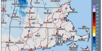
A significant storm system is set to bring cold, heavy rain to most areas of Massachusetts through Friday, with snowfall anticipated in the Berkshires and Worcester Hills as conditions are projected to improve over the weekend.
Rain Spreading Across the State
As of early Thursday, rain has begun to move across the state and is expected to persist throughout the day. The most consistent rainfall is anticipated from Thursday evening into early Friday, as the storm travels south of New England.
Potential for Snow in Higher Elevations
While the majority of Massachusetts will experience rain, a drop in temperatures on Friday may result in snow at higher altitudes. The Berkshires could see a light accumulation of snow, potentially reaching a few inches primarily on grassy surfaces. The Worcester Hills might record lesser amounts. Road conditions in these elevated regions could deteriorate, becoming slick or slushy as temperatures decrease on Friday.
Temperature Variations Across Massachusetts
Temperatures throughout the state on Thursday will vary significantly. Forecasts suggest that Pittsfield may only reach around 43 degrees, whereas Worcester is expected to hit 50 degrees, Springfield 51 degrees, Boston 53 degrees, and Hyannis could rise to 56 degrees.
Local Forecast Highlights for Thursday
- Boston: High 53°, Low 38°, Rain expected primarily after 4 p.m.
- Hyannis: High 56°, Low 50°, Rain expected mainly after 5 p.m.
- Pittsfield: High 43°, Low 35°, Rain
- Springfield: High 51°, Low 34°, Rain
- Worcester: High 50°, Low 33°, Rain expected mainly after 3 p.m.
Cold Snap Anticipated on Friday
On Friday, temperatures will drop further, especially in higher elevations, which may struggle to exceed the upper 30s. Meanwhile, locations along the South Coast could see temperatures in the mid to upper 40s.
Adverse Conditions for Travelers
Travelers should prepare for rain-slicked roads through Friday, along with potentially icy conditions in western Massachusetts where snow may mix in.
Wind and Coastal Impact
The storm system will produce gusty winds in coastal regions, including Cape Cod and the Islands. Winds could reach speeds of 25 to 30 mph Thursday night into Friday morning.
Coastal Flooding Warnings
Minor coastal flooding is a possibility around Nantucket Harbor due to high tides projected for Friday afternoon.
Advisories Issued by the National Weather Service
The National Weather Service has issued a small craft advisory for Boston Harbor and Narragansett Bay from 6 p.m. Thursday through 7 p.m. Friday. A gale watch is also in effect for offshore waters, where gusts could reach 35 knots.
Improving Conditions Ahead
As the storm moves out, precipitation is expected to diminish by Friday evening. The upcoming weekend promises much calmer weather, with dry conditions forecasted for both Saturday and Sunday, although breezy conditions may persist. High temperatures are projected to start in the upper 40s on Saturday, gradually rising to the mid-50s by Tuesday and Wednesday.
Chilly Nights Ahead
Nighttime temperatures will remain brisk, potentially dipping into the 20s through the middle of the upcoming week.

Chief Editor of Quincy City Beat — Quincy, MA's independent investigative newspaper covering Greater Boston and the entire Commonwealth of Massachusetts with fearless public accountability and free access for all readers.









Discussion about this post