


Potential Winter Weather in Massachusetts This Week
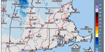
Parts of Massachusetts may experience wet snow later this week as a new storm system approaches New England. However, the majority of the state is currently predicted to receive rain accompanied by strong winds.
Snow Chances Isolated to Higher Elevations
The Berkshires and the elevated areas of the Worcester Hills could have the highest likelihood for snow accumulation, as cold temperatures could allow for a mixture of wet snow during the onset of the storm, expected from Thursday night into Friday.
Uncertainty Surrounds Storm’s Impact
The precise trajectory and intensity of the impending storm remain unclear. Although snow in Massachusetts is not the most probable scenario, forecasters anticipate having more insight into the storm’s behavior and potential snowfall locations as the week develops.
Monday’s Weather Overview
On Monday, residents across Massachusetts are facing a largely cloudy day with the possibility of light, scattered showers continuing into the afternoon. The greatest chances of rain are expected in Western Massachusetts, particularly in the higher terrain and Berkshires. However, significant downpours are not anticipated, with showers likely diminishing by sunset and clearing during the night.
Temperature Estimates and Wind Conditions
Temperatures on Monday are expected to range from the upper 40s in the Berkshires to the mid- and upper 50s in urban areas such as Boston, Springfield, and Cape Cod. Specifically, Boston may reach a high of 58 degrees, with Springfield and Hyannis likely hitting 57, and Worcester peaking at 56. In contrast, Pittsfield is forecasted to remain cooler, with a high around 49 degrees.
Wind gusts are projected to increase throughout the day, reaching speeds of 20 to 25 mph, especially in elevated regions.
Dry Conditions Expected Midweek
Looking ahead to Tuesday, a brief reprieve from unsettled weather is anticipated, as drier yet breezy and cooler conditions settle in across Southern New England. High temperatures are expected to remain in the 50s, while nighttime temperatures could drop into the 30s and lower 40s. Wednesday is projected to be mostly calm with seasonal temperatures and lingering cloud cover.
Late-Week Storm to Monitor
Attention will shift to the late-week storm, which may develop off the mid-Atlantic coast and move toward New England between Thursday night and Friday. In addition to the potential for wet snow in higher elevations, this storm could bring rain and wind gusts of up to 35 mph.
The amount of cold air present and the storm’s final path will influence whether precipitation remains entirely rain or transforms into snow in parts of Massachusetts.
Advisories for Offshore Conditions
Rough sea conditions are also predicted offshore earlier in the week. A Small Craft Advisory is issued for the southern outer coastal waters, valid until 7 a.m. on Wednesday.
Weekend Preview
Following the late-week system, cooler temperatures and brisk northwest winds are expected as the weekend approaches.

Chief Editor of Quincy City Beat — Quincy, MA's independent investigative newspaper covering Greater Boston and the entire Commonwealth of Massachusetts with fearless public accountability and free access for all readers.








Discussion about this post