


Severe Rainfall Hits Southeastern Massachusetts, Flooding Reports Emerge
Heavy rainfall inundated southeastern Massachusetts on Friday evening, resulting in flooding across parts of Cape Cod. The forecast indicates that several more inches of rain could accumulate overnight.
Intense Precipitation and Flooding Challenges
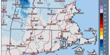
The most significant rainfall was observed in Cape Cod and surrounding southeastern regions, where a stalled weather front continuously delivered moisture to the same areas. Flooding has already been documented in Falmouth, with conditions expected to worsen.
Further Rainfall Anticipated
Additional rain between 1 to 3 inches is likely for the South Shore and Cape Cod before the storm system begins to move out early Saturday morning. This may complicate overnight travel, especially in low-lying and flood-prone areas.
Flood Watches in Effect
Flood watches are currently in place across much of southeastern Massachusetts and Rhode Island, lasting until Saturday morning.
Weather System Development
This extended rainfall aligns with a strengthening weather system heading toward the Gulf of Maine, which is expected to shift the stalled front eastward, thereby alleviating the heavy precipitation.
Improvement in Conditions Expected
Although conditions should progressively improve on Saturday, total dryness is not anticipated. A blend of clouds and sunshine will prevail, with the possibility of scattered rain showers in the afternoon. High temperatures are forecast to reach the low 60s, representing a notable decrease from the unusually warm conditions experienced earlier in the week.
Seasonal Weather Change
This change will usher in cooler and less humid air, making the weather feel significantly more like November. As the week progresses, most areas in Massachusetts will trend toward cooler and drier conditions.
Temperature Forecast for Upcoming Days
High temperatures are expected to dip into the 50s, while overnight lows will generally fall to the 30s and 40s. Monday and Tuesday could witness breezy or windy conditions due to additional fronts sweeping through New England, although little to no additional rainfall is expected.
City-Specific Temperature Predictions
On Friday, Boston, Springfield, and Worcester were anticipated to reach the upper 60s before the arrival of cooler air. Pittsfield could also see upper 60s, while temperatures around Hyannis were expected to remain in the mid-60s.
Quiet Weather Ahead
Once the heavy rain subsides, the middle of next week appears to be relatively calm. Daytime temperatures are likely to stay in the 50s, while colder nights accompanied by brisk westerly winds will contribute to a more typical November atmosphere.

Chief Editor of Quincy City Beat — Quincy, MA's independent investigative newspaper covering Greater Boston and the entire Commonwealth of Massachusetts with fearless public accountability and free access for all readers.








Discussion about this post